Thursday, June 30, 2011

THE LONGEST WATCH

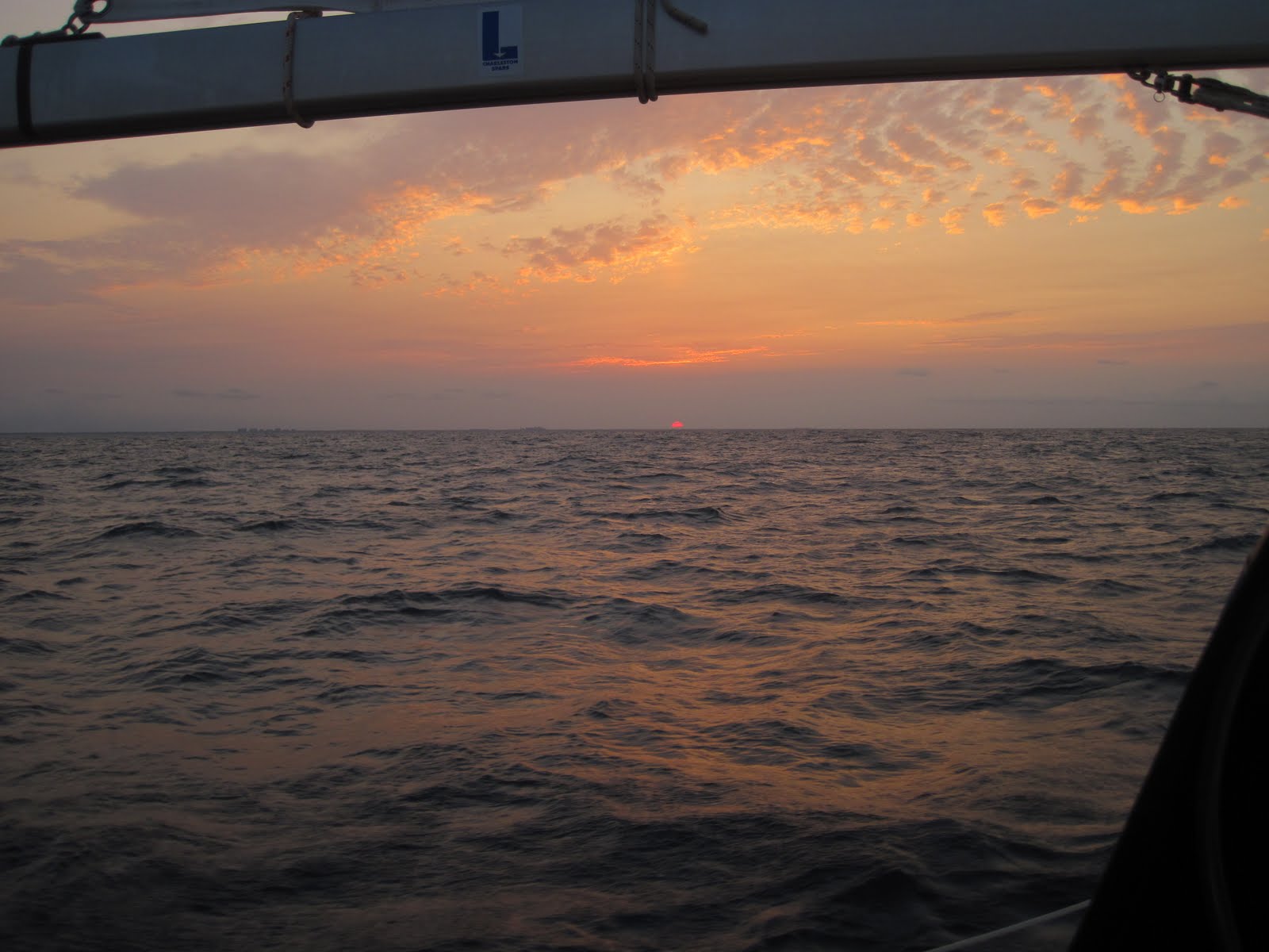
Alligator River, NC 35º40.398N | 76º03.402W

Unsettled in Oriental
I've gritted my teeth through some long watches, usually in expected places like Tongues of Oceans, but this one topped my list -- and it was only two hours.

Our short hops up the coast have continued, stopping at another favorite spot: Beaufort, NC. I already wrote about our history with Beaufort when we passed through last fall, four days into our cruising career.

This time, as always, we enjoyed the shops and restaurants, tooling around before an early morning run to Oriental.

We lifted anchor in Beaufort at 8:07, and I was feeling slightly queasy. Strange. I took a slug of Pepto, which usually kicks seasickness for me, even the tiniest sip. But why was I seasick? We'd been underway for weeks -- and conditions were mild.

My watch was to last until 10, and every minute I felt worse and worse. By 9:45, I was counting seconds, miliseconds, in an unending blur of nausea.

When Chip took over at 10, I fell on the couch and didn't budge until we approached Oriental. We tried unsuccessfully to anchor (although I do consider running aground a form of anchoring), so as a last resort we hailed the marina.

On this northern trek, I'm in charge of docking, so I took the wheel and pulled into a pencil-thin slip, threw a stern line over the piling, rodeo-style, and shut off the engine.

I went below, collapsed on the couch in a cold sweat, and did not leave the boat for 48 hours.

Food poisoning. We know that now, because Chip followed my lead. Six months in the Bahamas with no food issues. Two weeks in the U.S.: food poisoning.

Nachos. Good old American nachos in Beaufort.

We hobbled out of Oriental this morning and chose to take the inside route to Manteo. The capricious Pamlico on a still-queasy stomach? No thanks.

We're anchored in the Alligator River, feeling stronger and excited, one stop away from our home port!

Heading toward Beaufort.
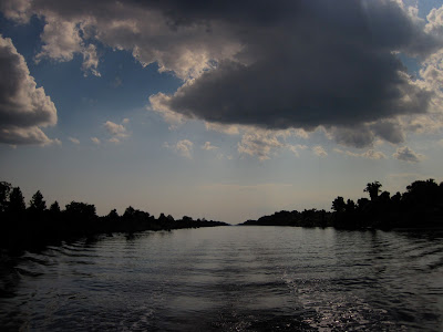
Scenic Alligator River.

Sunday, June 26, 2011

REVISITATION

Swansboro, NC 34º41.152N | 77º7.072W

New policy: work 'til you get there, have fun when you do.
After several long days, we've decided to make three short hops, treating ourselves to some of the spots we love along the way. Besides, today is Saturday, and one thing we've learned: all the folks who just bought blue light special water toys come out to play with them on the weekend. The less time we spend with rednecks dragging their progeny through questionable waters on anything that floats the better. Charles Darwin. You have work to do here.

Starting earlier than most rednecks, we made an easy six-hour hop to Swansboro, for no other reason than to visit a pub we like here (who's a redneck now?). This little town caught us unawares last October when we were newly minted cruisers, before we had experienced first-hand the many charms of ICW towns.

Tonight we revisited that pub and then sat on the porch with locals at the cigar shop across the street. It was a pleasant conversation until the topic turned to one that seems to be on everybody's mind these days: healthcare. One woman actually seemed to say she could never cruise, because she was afraid to be away from health care facilities. Her husband didn't agree.

We left them there and went to check on Cara Mia, anchored in a swift current upstream from a concrete bridge. As always, she was right where we left her, happy to welcome us home.

Saturday, June 25, 2011

NORTH BY NORTHEAST

Monday, June 20 
Charleston, SC 32º47.351N | 79º55.461W

With our one-week vacation in Charleston behind us, our focus is now making tracks north to Manteo to see our kids and friends.

Tuesday, June 21
Butler Island, SC 33º25.765N | 79º12.006W


First stop: Butler Island, where we anchored at 7:04 p.m. after 73 miles, 10 hours of motorsailing and riding swift currents. This is the kind of spot that, if you didn't know the sad reality, gives the impression that the whole world is at peace.

Wednesday, June 22 
North Myrtle Beach, SC 33º51.09N | 78º39.27W

A peaceful 7:24 a.m. getaway.
Today's destination was an empathy stop. Karen & Dale on Jessie Marie left Charleston a day ahead of us. We weren't sure when or where we would see them again until we got this text:

"Engine blown. Waiting for a tow."

We stopped in North Myrtle Beach to commiserate with them only to find they had taken their plight with good ol' Canadian unflappability. Seeing they might be here for a while, they rented bikes and contentedly settled in for a spell.

It was great to meet one of our blog readers here in North Myrtle -- a soon-to-be cruiser still plodding TO paradise. It's gratifying to pass along the kind of encouragement and support we've received on our extremely slow ploddingTOparadise.blogspot.com.

Learning the value of doing chores underway. Free time!
Friday, June 24 
Topsail, NC 34º23.680N | 77º35.809W

Moving water.     Photo by Chip
We pushed a lot of water up the ICW today. After an 11-hour, 47-minute trek of 83 miles, we anchored in a less-than-ideal spot in Topsail. The wind was cranking, and there weren't any protected spots, so we have tucked way up into a shallow, residential neighborhood and are hoping for the best.

A peaceful (boring) day on the ICW caused me to enlist the autohelm remote.
Hi Barbara!

Saturday, June 18, 2011

BRINGING HOME THE GULF STREAM

Charleston, SC 32º47.351N | 79º55.461W


The first time I witnessed the rich cobalt blue of the Gulf Stream, I tried and failed to capture it in a photo, like I do.

This morning I was walking through the Farmer's Market in Charleston and saw this:


The artist, Katie Gates, conjured the Gulf Stream from sterling silver and blue striped agate.

See some of her other work here.
And now I carry the mighty and entrancing Gulf Stream on my finger. 

Let's hope this doesn't mean I'll get all stirred up in north winds.

Friday, June 17, 2011

CHARLESTON'S UGLY TRUTH

Charleston, SC 32º47.351N | 79º55.461W

Middleton Place plantation
I knew I would hate visiting a plantation, celebrating a grotesque history of human enslavement, but I agreed to go anyway. It was beautiful. I hated it.

There we were, white people walking the beautiful grounds built and maintained by enslaved black people.

At one point we passed a black employee raking the grass.

Now, I know in our politically correct thinking that we can't discriminate in hiring, but come on. Can't we exclusively hire white people to clip the grass on a southern plantation?

To further insult me, they charged $37 (a whopping $74 for both of us) to enter the grounds and have a tour of the 'house,' which turns out be a gentlemen's guest house, not the main house where the white, privileged family lived. That one burned down.

Okay, screed interrupted. The place was pretty. Here are some photos.


Fun and games.

Thursday, June 16, 2011

CHARLESTON'S NEW TREASURES

Charleston, SC 32º47.351N | 79º55.461W

Night on the town with Kaleo and Jessie Marie.
One of those questions I was asking the last post was readily answered here in Charleston.

For instance, how long until we plug in our power cord...

I was practically standing on the bow with the shore power plug in hand as we pulled in this slip at Charleston Maritime Center. It is H-O-T, and I was ready for some A.-C.

After plugging in, I spent the next hour crawling around in the hatches reattaching the air conditioning ducts, working up a good sweat in the process, making that frigid air all the more lovely once it started flowing. Welcome to summer in the U.S.

It is good to be back in this city we love. I've already written an Ode to Charleston, a place we bookmarked for our return trip.

When we were in Charleston last November, I had some inkling of the rich community of water people who share the cruising life, but I did not realize we had barely begun to string the necklace of lifelong friends we would gather on this inaugural voyage. These fellow travelers laugh with us at the foibles of cruising life, celebrate happy moments and sometimes tears with us, lend us a hand if needed (often) and keep an eye on us when necessary (always).

And now on our return trip, our love of Charleston has an added dimension with the companionship of these new friends. Two slips to starboard are Karen & Dale on Jessie Marie, who we haven't seen since our last stop in the Bahamas. Three slips to port are Matt & Christie on Kaleo, who we have been chasing but haven't seen since we were all in Long Island in March.

On this trip north, as we slowly make our way toward home waters, it would be easy to focus on what we left behind, but instead, our new friends remind us of how very much we have gained along the way.

Wednesday, June 15, 2011

HOW LONG?

Charleston, SC 32º46.832N | 79º57.599W

As I slowly re-acclimate to being back in the U.S., it is clear to me that I have changed. Six months in the Bahamas has taught me to use my time and resources much more prudently than I did when I lived on land -- or even when living onboard in the U.S.  This leaves me wondering ...

How long will I conserve water like it's gold?

How long will I resist the ever present Internet, leaving my laptop to be the occasional novelty, not an appendage?

How long will I go without consuming and taking on the attendant emotional burden of daily news?

How long will I appreciate the bounty of strawberries, avocados, melons and dark chocolate, available everywhere, any time?

And how long will I eat only when I'm hungry and not because it's there?

How long until we "plug in" our power cord -- physically and metaphorically -- leave our green habits behind?

How long will I practice one lesson learned from the sweet people of the Bahamas: look people in the eye and greet them kindly?

And most importantly, how long will I maintain the gentle pace of Bahamian life, resist the frenetic energy and hurry-up pulse of daily life in our country?

Tuesday, June 14, 2011

TROLLING THE ARCHIVE

We were recently nominated by our friends on Kaleo to participate in a travel blog initiative called 7 Links by Tripbase, where travel bloggers troll their archives, fishing up their best and favorite posts in predetermined categories.

This was much harder than I thought, but here is the end result.


MOST BEAUTIFUL :: THE SCIENCE OF PINK


I often put my writing and my photography in separate entries, but I had one post that seemed to knit together words and photos in a way I wish I could do more often.


If you would prefer to interpret "beautiful" as visually beautiful, you might like these two:


MOST POPULAR :: THE WOMEN OF FREEDIVING


The most unexpected occurrence in our first year of cruising was our brush with freediving in Long Island, Bahamas. I wrote and published an article about it in The New York Times.

Because of that article, the freediving community has discovered my blog and this post about  THE WOMEN OF FREEDIVING, which I should have called The AMAZING Women of Freediving.

You can see the top five most popular in the left margin of this page.


MOST CONTROVERSIAL :: THINGS I SHOULD NOT DO

Apparently fear is controversial. I see my blog as a blueprint for other wannabe adventurers. I talk about everything, good and bad, highs and lows. It seems some folks either don't want to hear about the lows or take them more seriously than I do. My inbox -- and even Chip's -- got blasted with all manner of reactions to this blog about fear.


Those who didn't stop reading my blog at that point, could witness how quickly overreaction turns to sanity: 


MOST HELPFUL :: THE REALITY OF DREAMING


Since I don't write travel tips or outright advice about sailing, I chose a more esoteric post that I truly hope is helpful. It is about dreams becoming reality and how that reality can far surpass the dream. It's called the THE REALITY OF DREAMING.


MOST SURPRISING SUCCESS :: TONGUE LASHING


I'm a writer of few words, trying to pack as much as I can in as few words as possible -- driven in part by the fear of boring my readers. That's why it surprises me that  TONGUE LASHING, at 1,755 words, is ranked second overall in page views (at the time of this writing). My more typical blog post runs much shorter like this TWO GENERATIONS, ONE DREAM or BETTER THAN HOPE.


DIDN'T GET ENOUGH ATTENTION :: OUR NEW WORLD

The long-awaited day we untied our lines and finally, finally left our home port, I changed from my old blog URL, ploddingTOparadise.blogspot.com to the new ploddingINparadise.blogspot.com. Because of that switch, I think many of my readers missed this post about the emotion-packed and weepy first day of the rest of our lives.


MOST PROUD OF :: PARADE OF DREAMS

This was by far the hardest post for me to choose. There are different reasons to be proud of posts, but after much pondering, the ones I am most proud of are those that pack the most emotional punch. I decided on this one called PARADE OF DREAMS from the old blog. It captures for me the challenges of waiting and the potential perils of chasing a dream even though, at the time it was written, I had no idea it was two months before the house sold, almost  two years before the business sold, and a whopping 26 months before we started cruising.

For the record, my runners up were:
MARKERS, about roots
THE ULTIMATE KINDNESS, about sacrifice
LOVE ME TENDER, about loss


NOMINATIONS

The last assignment is to nominate five other bloggers. My choices are all sailors:

Anastasia: http://www.sailblogs.com/member/anastasia/, treasures we uncovered in Long Island, Bahamas.
Saralane: http://sailingsaralane.blogspot.com/, adventurers we encountered in Georgetown, Exumas.
Snowbird: http://swedishsnowbird.blogspot.com/, the Swedish kids we fell in love with in Georgetown, Exumas.
Knotty Cat: http://knottycattales.blogspot.com/, written by Laura, whom I've never met but enjoy reading.
Unicorn: http://www.sailunicorn.com/, world cruisers we found in St. Mary's, Georgia, and reconnected with in Vero Beach, Florida, and Georgetown, Exumas.

Monday, June 13, 2011

EARNING OUR WAY TO CHARLESTON

Charleston, SC 32º46.832N | 79º57.599W

Attentive readers might remember how we fell in love with Charleston last December as we passed through, bookmarking it for a visit on our return swing north.

Yesterday we set off from Cumberland Island for yet another 24-hour passage, entirely skipping Georgia and its 9-foot tides.

In a frustrating continuation of our ships-passing-in-the-night phase, as we were leaving, our friends Christie and Matt on Kaleo were anchoring across the way in Fernandina, but we were glad to hear they are Charleston-bound as well.

The generous inlet of the St. Mary's River was shrouded in dense smoke as we sailed out mid-morning. Apparently large chunks of the southeast are on fire. We leave you folks in charge of the country for a few months, and you set the whole place on fire!

The wind was brisk and lovely, from the east as we set our course northeast toward Charleston. The forecast was dreamy: 0-1 meter of swell, wind in the 10-15 knot range, perhaps dropping during the night.

We passed an enjoyable day of near-perfect sailing accompanied by a strong sense of foreboding, remembering that damnable pattern of the last two passages: perfect by day; hell by night.

And you know what? We were right -- except for one thing: it was far, far worse.

After sunset, the sea state got increasingly agitated. By midnight it was tossing us about in 8-10 foot swell with a random 12-footer thrown in. What direction? On our beam, of course.

The wind apparently did not read the forecasts, because by midnight it was howling a steady 25 knots, gusting even higher. From where? You should know the answer by now: on our stern quarter, clocking slowly behind us.

Same routine as the last two overnighters with the volume on 10. Sigh.

It's a funny thing about sailing. On a tack off the wind, you loll along surfing the waves, thinking this wind isn't so bad, but then you turn on the opposite tack, and it's as if somebody switched the weather channel. The bow pounds through the waves, the screeching wind blasts against the sails (and your face) and you feel like you're rocketing out of the atmosphere -- even though, according to the knot meter, you're actually going slower.

On our two previous passages with similar but lighter conditions, we were able to hold our course reasonably well, but this time, if we kept our course, the rocking and rolling was truly unbearable. We had to zigzag west toward shore, running downwind, then east, out to sea, hopefully on average, keeping our course to Charleston.

During his 3 to 6 a.m. watch, Chip altered our course, finding a better route that was a wee bit more tolerable. On my 3-6 shift, the swell slowly, inch-by-inch started to ease and by the time I came back on watch, the sea state had calmed, and the sun was just beginning to lighten the sky.


The sun must have had a rough night too, because all morning it threatened to just go on back down.

Since when does the sun set in the east?
We passed the morning peacefully, snatching little catnaps in the cockpit thanks to calmer seas.

Well-earned rest after a fitful night.
By noon we turned into the long channel leading into our dear Charleston, dropping anchor in the Ashley River for a good long sleep, resting up for our weeklong date with this fine southern city.

Sunday, June 12, 2011

THAT TEMPERAMENTAL OCEAN

Cumberland Island, Georgia 30º46.403N | 81º28.602W
The sun setting over the calm yet capricious ocean.
How different I feel as we retrace our path north. Seven months ago, as newly minted cruisers passing through this same stretch of Florida, we had yet to sail in the ocean, still using our time toiling south for outfitting and rigging, preparing the boat and our nerves for the rigors of offshore sailing. Seven months ago, we threaded tiny stitches down the ICW, taking two weeks to cover the same distance we traversed offshore last night in only 24 hours.

Such a short few months later, we don't hesitate to abandon the grumpy bridge tenders and wake-making power boats for the mysteries of the deep.

And truly, you gotta wonder what mysteries await when you step into Neptune's territory.

With our GPS routed to our much-loved Cumberland Island on the Florida/Georgia state line, we threaded the slim Ponce Inlet mid-morning in unsettled waters, turning north in a brisk breeze from the east. We briefly considered reefing the main (pulling in some sail) but waited a bit to see how reliable that breeze would be.

The forecast was sketchy, calling for the wind to get light and clock, perhaps all 360˚ overnight with little or no swell.

They were half-right.

We had a beautiful day of sailing on smooth water with a good wind that settled right down, no reefing required.

This sure beats two weeks on the ICW!
Then the sun set and all hell broke loose. Does this remind anyone else of our Gulf Stream crossing?

The swell gradually increased after sunset, rising to 6-8 foot swells by midnight, right on our beam if we kept our course. The wind dropped and started clocking around behind us, practically useless.

These conditions always make me wonder, as I'm sure I've said here before, how loud music purloined the term Rock 'n' Roll, a name much more suited to our rock, rock, rock, ROLL. And why is it invariably in the dead of night?

On my 9-midnight watch, I struggled to get any power I could manage out of the light wind, anything to stabilize us in the broiling swell, I discovered that, oddly, the jib does better running on light wind if it's reefed. Who knew. I was able to keep it full much better by reefing it down to a smaller slice of canvas. I tried to snake as close to our course as possible without pitching us all in the drink from the rocking.

But, as predicted, the wind kept clocking, making a full circle by the time we were done.

We enjoyed the day and alternately endured the night, delighted to see the sun finally rise and the damned swell begin to unfurl.

I think I've got the ocean figured out. She's a primadonna, docile and perfectly lovely in the spotlight of day, a total freakin' bitch by night.

We set our anchor just off Cumberland after 24 hours of sad near misses. Leaving Ponce Inlet, we learned we had anchored less than two miles from our friends Eric and Annie on WeBeSailing, whom we haven't seen since we left them in Rose Island in February. Making our way into the St. Mary's inlet, Karen and Dale on Jessie Marie radioed us on our their way out, forging the path we will take tomorrow: a 24-hour passage to Charleston.

Fort Clinch on the southern shore of St. Mary's River.

Friday, June 10, 2011

PRESSING NORTH

Ponce Inlet, Florida 29º03.658N | 80º55.834W

A scene along the Florida ICW.
Our first 24 hours in the U.S. were a whirlwind of activity, starting with a good old scrub-down for Cara Mia. For the first time since we left Miami in January, we reveled in FREE WATER, hosing, washing and rewashing the deck, the hull and spraying everything in sight. Then off to the showers and more free water!

Realizing our pantry was close to empty -- as were those prescriptions -- we decided to lay over a day in Cape Canaveral to take care of business. We rented a car and threw ourselves into the fray. The traffic moves so fast -- and on the "wrong" side of the road!

First impressions:

  1. Wow, everyone's in such a hurry.
  2. Why aren't people greeting each other and making eye contact?
  3. The stores are immaculate, brightly lit, full and perfect. Everything is SO proper!
We spent about 30 minutes in Publix grocery store before being overcome with sensory overload. So much food. So many choices. So many colors and shapes and sounds, but oddly, no smells.

Exhausted by a full day of brushing with "our people," we untied the lines and took off this morning on the ICW. We made a short passage inside to get some chores done underway and get our new purchases safely stowed before heading offshore again tomorrow, another 24-hour passage from Ponce to Cumberland Island on the Florida/Georgia state line.

Wednesday, June 8, 2011

IDENTITY THEFT

Cape Canaveral, Florida 28º24.51N | 80º37.655W

I stood in the Cape Canaveral Walgreen's in a cold sweat. It was clear to me that someone was trying to steal my identity.

Unfortunately it was me.

I was attempting to fill a prescription, but during our long absence from the country my insurance card had been mailed to my P.O. box in Delaware. I called Blue Cross Blue Shield to get my member number.

It took four minutes of arguing with the automated voice mail system to get through to a human.

"What is your member number," the human asked.

"Um, I don't have it. That's why I'm calling."

"Okay, no problem. Whose name is the policy under?"

Problem.

It had been so long since we had used it, I couldn't remember if it was under me or Chip. I got it wrong the first time. Suspicion level yellow.

"Okay, can you verify the phone number on the account?"

"Um..."

Problem.

That might be easy enough for people living normal lives, but for the twangled life of a wanderer it's a real problem. The correct answer could have been the wine shop we owned -- and worked from -- when we got the insurance policy. It could have been either of our now-defunct cell phones. I struggled through, trying to exude the confidence I lacked, and guessed right on the third try. Suspicion level orange.

I successfully retrieved the insurance card number only to be told by Walgreen's that they needed an additional number for prescriptions. Repeat previous paragraph straining to remember the correct answers.

Finally, with prescription number in hand, I returned to the pharmacy to pick up my prescription.

"Okay, to verify, we just need the address on the account."

AAAAAHHHHHH!!!!!! This multiple choice question had even more possibilities: our old house, long since sold, the apartment we rented for four months, the house we rented for five months, the wine shop, the Delaware P.O. box.

"Is it a North Carolina address?" I asked, playing 20 questions.

"Yes."

Fortunately the phone rang just then, so I had several minutes to ramble through my jumbled brain searching for the correct answer. I was pretty sure it was our house, but what was the address?? It had been three addresses and two years since then. Think. Think. Suspicion and stress level RED.

Just as the clerk hung up the phone, I remembered the name of our street. (I always work better on a deadline.)

"Sir Chandler!" I practically shouted, channeling Rain Man.

She handed over the drugs, and I fled, my identity but not my nerves intact.

Tuesday, June 7, 2011

FLYING FISH & ROLLING SWELL

Cape Canaveral, Florida 28º24.51N | 80º37.655W

We're the line going northwest, Great Sale to Cape Canaveral.
You never really know what you're sailing into when you head into the ocean. It's part of the allure. The weather guessers predicted very light winds from the east, clocking to the south and dropping during the night.

As planned, we lifted anchor in Great Sale, Abacos, mid-morning yesterday for a 24-hour crossing to Cape Canaveral. We sailed onto the Bahama Banks under this:


Good omen or bad? Either way, it was lovely.

Counter to predictions, we had a beautiful sail across the Bahama Banks toward Mantanilla Shoal, skimming over smooth turquoise water with a brisk breeze. What's not to love about that? It was northeast wind.

Northeast wind + Gulf Stream = bad. The Gulf Stream flows south to north, so any wind blowing against it kicks up waves.

We sailed safely off of the Bahama Banks into deep water without incident -- and without much swell so far. I made Chip take the 6-9 watch, because, for the first time, this impending darkness with a northeast wind riling the beast ahead filled me with foreboding. Not a we're-all-going-to-die fear but more of that uneasiness you have sitting in the dentist's chair before a root canal, knowing even at it's best, it ain't gonna be that great.

On second thought, the sun setting over the water is so calming.
On we sailed as the wind eased back, clocking more to the east, and the swell increased. I took the helm for my 9 to midnight shift in moonless, inky darkness. The swell was coming on our stern quarter, 4-6 feet with the occasional 8 footer. I could keep our course but not without a swaggering roll that was uncomfortable but just short of miserable. I found songs on the iPod that kept the same beat and worked the roll into my dance step. I had a pretty good dance routine going until I whanged my knee on the wheel. Ouch. At least it was dark, and, as far as I know, nobody was watching.

As the wind clocked around almost behind us, not quite, I tried to cheat it. We had been motorsailing for a while and having any sail up makes the ride smoother, so I had been letting out the main as far as possible to keep some traction in the swell. As the wind dropped, the pressure on the main also lessened, causing it to flop around occasionally when we teetered back and forth in the swell.

When Chip came on watch at midnight I told him I was getting worried we might jibe (where the wind gets behind the sail and bangs it across to the other side), so he rigged up a preventer using sail ties and line. I observed that it would likely give way if we really did jibe, but he said his goal was to slow down the boom to lessen the impact. A proper preventer (a rig that holds the boom in place to prevent accidental jibes) is on the very long list of things we need to do this summer.

So off I went to try to sleep in the wildly rocking cradle of a v-berth, stuffing pillows all around me to keep from flopping around too much, my own preventer. Just as I was drifting off, I felt the boat buck and heard a loud WHAM. I knew what it was. We had jibed.

I ran to the cockpit, and Chip turned over the wheel.

"Point into the wind while I get the preventer off," he said.

So, half asleep, I took the wheel in the pitch black and tried my best to point into the invisible wind and deal with the nasty swell, while Chip was up there in no-man's land on the cabin roof.

Our policy offshore is that anyone leaving the cockpit wears an offshore lifejacket with a leash tied off in the cockpit. While that is theoretically comforting, the reality is less so. All I could think about was if he went overboard, how I would reel him back in while keeping the boat stable.

Mid-thought the wind caught the sail and whammed it across the boat again, flying over Chip's head as he went spread eagle on the cabin roof, hanging onto, well, nothing. I got us stabilized again but couldn't tell if the boom had hit Chip on it's way across or if he had gone down on his own.

It's amazing how terrifyingly long two seconds can seem in the middle of a black, bucking ocean.

He jumped up and came running back to the cockpit.

"Point in again so I can drop the main."

In that moment I was deliriously happy that we had waited for this night to cross the Gulf Stream. Why? Because we took the time to fix the Dutchman flaking system that catches the mainsail as it drops. We had considered leaving the lines off and managing the sail the old fashioned way: Catching miles of billowing canvas, piling it onto the boom by hand and tying it in place with sail ties.

Instead, with the newly repaired system in place, Chip released the halyard, and the main dropped mostly into place, although the lightening wind and the roll of the swell made it messy. He quickly got it under control, and I turned the boat back on our old rolly course.

"That was fun!" Chip said, without a hint of sarcasm.

Well, the other of us didn't think so. We debriefed, and I went below trying to quell the piping adrenaline and get some rest.

Chip fought the swell until my 3 a.m. watch then dropped exhausted onto the cockpit bench while Bill Cosby and David Sedaris entertained me on the iPod.

About 20 minutes later, Chip came shooting up out of sleep yelling, "Squid!"

Of course I thought he was dreaming, even when he started clawing at the neck of his jacket.

"Oh, it's a fish," he said.

I pulled out my flashlight, and sure enough, here's what I saw:

The wayward flying fish that whispered in Chip's ear.
We had been seeing flying squid all day, thus the SQUID alarm, but this was a standard issue flying fish that had haplessly flown into the cockpit, right into sleeping Chip's ear and tried to flop under his collar.

Now who had adrenaline pumping? Both Chip AND the fish. The latter got pitched overboard, the former sent below.

The swell mellowed a little, and David Sedaris and I steered us through to just before dawn without further incident, other than the rush of seeing the knot meter hit an all-time high of 8.9 as the Gulf Stream carried us north. It did make me do a double-take when I first observed the real-life occurrence of set and drift, where the magnetic compass goes at odds with the GPS heading, because the GPS registers our northern flow in the Gulf Stream. The instruments might not have agreed on which way we were heading, but boy, were we getting there f a s t.

Chip took the last watch that brought the sun up behind us and our country before us.

Cape Canaveral ahead.
Just short of 24 hours after leaving Great Sale, we tied up in Cape Canaveral in green, murky water, tired and happy, ready for proper land showers and whatever culture shock might await.

Monday, June 6, 2011

TIME TO GO!

Great Sale Cay, Abacos, Bahamas 26º58.612N | 78º12.954W


After weeks of watching the weather and maneuvering into position, we are finally leaving the Bahamas, crossing the Gulf Stream to Florida: Destination Cape Canaveral.

We predict it will take about 24 hours, so we are leaving mid-morning, hoping to be off the Bahama Banks in the last of daylight, reaching that capricious lion-or-lamb of a Gulf Stream in the dead of night.

We have offered the beast about 48 hours after a big blow, time enough to calm down, theoretically. Unfortunately, the wind has calmed as well, so there might be some motoring. (Some sailors consider it a failure to use the engine, but, hey, the engine is a tool in my toolbag, no better or worse than others. Whatever it takes to get us across safely!)

And so we leave with heavy hearts. Our first season of cruising the Bahamas is ending, but family and friends are waiting on the other side.

Gulf Stream and Cape Canaveral, here we come.

Sunday, June 5, 2011

CAN WATER BE SAD?

Great Sale Cay, Abacos, Bahamas 26º58.612N | 78º12.954W

Cara Mia, all alone in Great Sale.
You remember that bet we had about how many boats would leave for the U.S. today? Chip said there would be 7 boats left here with us. I said 6.

By noon, we were the very last boat in this large, lonely anchorage. All 11 boats left to cross the Gulf Stream to Florida. Once again, we said bye to Jessie Marie as she set off on Karen's birthday. We hope to meet up with them again in Charleston next week to give Karen her presents.

There was a time when it would have bothered me that we were the only ones who chose to stay. I would have had nagging second thoughts. What do they know that I don't? What if they're right and I'm wrong?

I still might -- and should -- ask those questions, but every day I grow more confident with our decisions. We decided to wait until Monday to cross the Gulf Stream. We are not right. The others are not wrong. We merely made decisions. They made theirs. We made ours. And so we all go in our own time.

Which leaves us with wide open time and space to do our chores, chores made so much more pleasant by our gorgeous surroundings.


First chore: Fix the Dutchman flaking system (lines running through the main sail that make it fold nicely and stay in place when we drop it) that broke coming into this anchorage. Lots of fits and starts (mostly fits) trying to fix that one, but with persistence and patience, we got it done.

Our wide open anchorage leaves us time to ponder returning to our own country, our own culture after being gone for six months. I think about what has changed and, other than the price of gas, I'm pretty sure most of those changes are in me. Looping back around where we came from inevitably leads to retrospection. There's your warning: lots of reflective posts coming.

But most of all, right now in this quiet anchorage, our last in the Bahamas, I'm looking into turquoise water and thinking about how much I'll miss it.

As if the water is feeling a bit melancholy too, it has gone cloudy on me, brilliant turquoise but no longer clear as air. Maybe it's just kindly weaning me off its splendor.


Bye bye turquoise water. How I'll miss you.

Saturday, June 4, 2011

CARA MIA :: Our Most Experienced Crewmember


CARA MIA
1999 Island Packet 380  
Designer: Robert Johnson

Hull Material: Fiberglass

Length Overall: 39'7"     Length at Waterline: 32'0"     Beam (width): 13'2"
Displacement: 21,000 lbs     Draft: 4'7"     Bridge Clearance: 54'3"    Ballast: 9,000 lbs
Engines: Yanmar     Engine(s) HP: 51 hp FWC     Engine Model: 4JH3
Tankage  Fuel: 85 gal     Water: 170 gal     Holding: 40 gal


We bought Cara Mia in Rock Hall, Maryland, December 2009, from her only other owners, Marvin and Nancy Day, who sailed her through the Bahamas, throughout the Caribbean, the Med and up the French canals when she was named Good Company. We sailed her from Rock Hall to the Outer Banks in May of 2010, and the three of us untied our last land lines on October 23, 2010.

Cutter rig with one mast, three sails.

Full keel -- with a new paint job, July 2010.

Swim platform on the transom.


Dinghy
9 foot Caribe hard bottom with Tahatsu 3.5 hp

Safety Equipment
2 inflatable coastal life jackets, 2 inflatable offshore life jackets with harnesses, Revere 4-person life raft, 2 epirbs, flares, lifesling

Communication
VHF radio, 2 portable VHF radios, ICOM SSB

Anchors
Delta on electric windlass w/250 feet of chain, Fortress w/rode, CQR w/rode and chain

Power
350 watts of solar panels, Honda 2000 generator, 5 AGM batteries

Electronics
In cockpit: Garmin 740 GPS including radar and depth sounder, Raytheon backup depth sounder, wind speed, boat speed and autohelm with remote (yes, I use it sometimes, driving the boat from a position of comfort.)
Inside: backup installed Garmin GPS, handheld GPS, handheld depth sounder

Friday, June 3, 2011

THE LAST STOP

Great Sale Cay, Abacos, Bahamas 26º58.612N | 78º12.954W


The sun showing us the way to Florida.
Today's sail was a long one compared with the last few, 7 hours and 20 minutes from Spanish Cay to Great Sale in good wind. Well, when we turned south around the island the wind did start writing a chore list for us. It kicked way up, and blew the last remaining threads out of the bottom of the jib and broke one of the Dutchman flaking lines while we were reefing the main. That will give us something to do the next few days.

That weather window we've been waiting for is beginning to open. Our plan is to start our 24-hour crossing on Monday when we hope the Gulf Stream will have settled a bit, we have our chores done, and we can listen to another round of weather guessing on the SSB Monday morning.

That same weather has determined our routing as well. We had hoped to ride the Gulf Stream to either Fernandina or Charleston, but there's some sketchy activity south of Hatteras, so Cape Canaveral, here we come.

The sun is setting on Great Sale and the 12 boats anchored here The optimal departure time from Great Sale is midmorning, and Chip and I have a bet on how many neighbors we'll have by noon tomorrow. All or none or somewhere in between? Meet us at high noon to find out.