Showing posts with label turquoise water. Show all posts

Monday, June 6, 2011

TIME TO GO!

Great Sale Cay, Abacos, Bahamas 26º58.612N | 78º12.954W


After weeks of watching the weather and maneuvering into position, we are finally leaving the Bahamas, crossing the Gulf Stream to Florida: Destination Cape Canaveral.

We predict it will take about 24 hours, so we are leaving mid-morning, hoping to be off the Bahama Banks in the last of daylight, reaching that capricious lion-or-lamb of a Gulf Stream in the dead of night.

We have offered the beast about 48 hours after a big blow, time enough to calm down, theoretically. Unfortunately, the wind has calmed as well, so there might be some motoring. (Some sailors consider it a failure to use the engine, but, hey, the engine is a tool in my toolbag, no better or worse than others. Whatever it takes to get us across safely!)

And so we leave with heavy hearts. Our first season of cruising the Bahamas is ending, but family and friends are waiting on the other side.

Gulf Stream and Cape Canaveral, here we come.

Sunday, June 5, 2011

CAN WATER BE SAD?

Great Sale Cay, Abacos, Bahamas 26º58.612N | 78º12.954W

Cara Mia, all alone in Great Sale.
You remember that bet we had about how many boats would leave for the U.S. today? Chip said there would be 7 boats left here with us. I said 6.

By noon, we were the very last boat in this large, lonely anchorage. All 11 boats left to cross the Gulf Stream to Florida. Once again, we said bye to Jessie Marie as she set off on Karen's birthday. We hope to meet up with them again in Charleston next week to give Karen her presents.

There was a time when it would have bothered me that we were the only ones who chose to stay. I would have had nagging second thoughts. What do they know that I don't? What if they're right and I'm wrong?

I still might -- and should -- ask those questions, but every day I grow more confident with our decisions. We decided to wait until Monday to cross the Gulf Stream. We are not right. The others are not wrong. We merely made decisions. They made theirs. We made ours. And so we all go in our own time.

Which leaves us with wide open time and space to do our chores, chores made so much more pleasant by our gorgeous surroundings.


First chore: Fix the Dutchman flaking system (lines running through the main sail that make it fold nicely and stay in place when we drop it) that broke coming into this anchorage. Lots of fits and starts (mostly fits) trying to fix that one, but with persistence and patience, we got it done.

Our wide open anchorage leaves us time to ponder returning to our own country, our own culture after being gone for six months. I think about what has changed and, other than the price of gas, I'm pretty sure most of those changes are in me. Looping back around where we came from inevitably leads to retrospection. There's your warning: lots of reflective posts coming.

But most of all, right now in this quiet anchorage, our last in the Bahamas, I'm looking into turquoise water and thinking about how much I'll miss it.

As if the water is feeling a bit melancholy too, it has gone cloudy on me, brilliant turquoise but no longer clear as air. Maybe it's just kindly weaning me off its splendor.


Bye bye turquoise water. How I'll miss you.

Saturday, May 14, 2011

SIGHTS OF SPANISH WELLS

Spanish Wells, Bahamas 25º32.565N | 76º44.715W


Even their cemetery is colorful.
Spanish Wells supplies all the lobster for Red Lobster in the U.S.
The long-awaited Eleuthera pineapple.

Spanish eyes. (Same fish.)


A FISH TALE

Spanish Wells, Bahamas 25º32.565N | 76º44.715W


My fishless days seem to have ended -- for now. On the brisk sail to Alabaster Bay, in 16-20 knots gusting to 24, my fishing line suddenly screamed, catapulting me several inches off the cockpit seat at this still-new sound.

I grabbed the pole and could feel right away that this was a fish of a different stripe. I said something like, "Yikes."

It was a beast. I tussled with it, the rod bent almost in half while Chip ran for the alcohol (for the fish).

I wrangled and wrangled. We could see whatever was on my hook jump out of the water occasionally only enough for us to see, to my great relief, that it wasn't a shark.

Cranking it all the way up next to the boat, we peered over rail into the face of a 3-foot, pissed-off barracuda.

I reeled him slightly out of the water, and Chip poked at him with the fishnet until he broke free. We happily went our separate ways. I stowed the feathery lure that in my mind will always be coated in barracuda spit.

There are never pictures of the good stuff.

We quietly anchored in Alabaster Bay for the night and raised anchor at 7:15 a.m. to make the sketchy Current Cut with a favorable tide. We sailed through generous 15 knots of wind gusting to 20, and I hopefully dropped a lure in the water, one that by my judgment would be very unattractive to barracudas.

Just as we got the sails trimmed and were flying along at full speed, my line zipped once again. Now somewhat familiar with the sound, I jumped and grabbed the rod.

It was no barracuda, thank goodness, but there was surely something on there. Now the veterans of two fish, we more professionally tackled this one. I brought it up to the boat. Chip scooped it up in the net and poured vodka on its Spanish Mackerel gills.

Twenty inches of fresh yumminess.
And on we sailed, transiting the Current Cut without incident.

I keep thinking these little towns have achieved the pinnacle of picture perfection, and then we sail into a new one. 

A picturesque harbor.
And fairy tale houses.
Immaculate fishing boats.

Pristine beaches.
And a fresh fish dinner for four! Spanish Mackerel in Spanish Wells.

Monday, May 9, 2011

PARADISE UNINTERRUPTED

Warderick Wells, Exumas 24º23.744N | 76º37.925W


Launching from a pristine beach, NOT a swimming pool.
Photo by Chip


The view from my hanging chair -- looking through 12 feet of water.
Photo by Chip

Sunday, May 8, 2011

INTRODUCING WARDERICK WELLS

Warderick Wells, Exumas 24º23.744N | 76º37.925W
Looking east from Warderick Wells at a very peaceful Exuma Sound.
When we were in Warderick Wells in February, I was busy hosting our onboard guests and didn't sufficiently introduce you to this spectacular place, so spectacular that we decided to return.

Warderick is park headquarters for 22 miles of protected park land in the Exumas. Visitors can anchor or take a mooring but nothing else. All the plants and animals are off limits.

The mooring field where Cara Mia rests is tucked into the protection of the northern tip of the island.

Northern tip of Warderick Wells, mooring field the arc on the left.
The craggy island, typical of the limestone islands of the Bahamas, is arid but diverse enough to indulge the need to get off the boat and do some hiking.


Or play at the blowholes.

Boys just want to have fun.
Girls too.
The highest point on the island, Booboo Hill, has been adopted by cruisers as somewhat of a graffiti wall. The park allows cruisers to leave their boat name painted on driftwood at the top of the hill, creating a monument to some, an eyesore to others. You make the call:


There are amazing reefs close enough to swim to, happy aquatic creatures lolling about, even under the boat. If there is an idyllic place to enjoy the bounty of the Exumas, this is it.

A shark and its remora hanging out under Jessie Marie.
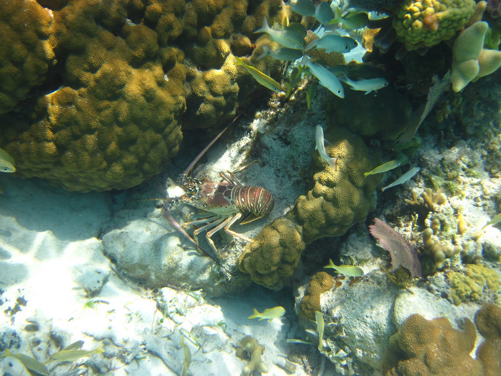
This enormous lobster is clearly flaunting life in the 'no take' zone.
Cara Mia sleeping in a peaceful Warderick Wells.   Photo by Chip

Saturday, May 7, 2011

WORKING BOAT

Warderick Wells, Exumas 24º23.744N | 76º37.925W
Sailing out of Elizabeth Harbor behind Jessie Marie and Katerina.
We've shaken off months of stillness and turned Cara Mia into a working boat again. Sailing out of Elizabeth Harbor with Jessie Marie and Katerina on Wednesday marked the beginning of our northern plod. All three boats stopped at Emerald Bay for free laundry (!) and to pick up Katerina's namesake returning from Canada, then once again set sail for Black Point and beyond.

Our plan all along has been for Chip and I to share the duties onboard, for both of us to know how to do everything. With a crew of two, even a minor incident, like a sprained wrist or seasickness, can leave either of us single-handing.

However, even with the best laid, as we headed south, we fell into "roles," unplanned tasks that we each handled all the time, born in part from survival instinct. Being new to our boat and new to cruising, the learning curve seemed taller than the mast. So, given the choice of learning 10 things or 20 things, we made an obvious if subconscious choice.


We decided that the day we turned to head north, we would swap duties, primarily the roles underway. For docking, anchoring and mooring, Chip has always been at the helm, I have always worked the lines. On the northern trek, we have traded roles.

And now the compass has turned.

Black Point was our first anchoring as rookies, and we both performed beautifully although not quite perfectly.

Today, pulling into Warderick Wells with its tight moorings and narrow channel, I was imagining somewhat of a parallel parking maneuver. I was fully prepared to chicken out, but our mooring ball was between two empty balls, wide open. Our first successful mooring: DONE.

Back on the amazing Bahama Banks.

Wednesday, April 20, 2011

SIGHTS OF LONG ISLAND, PART II

Salt Pond, Long Island, Bahamas 23º21.4N | 75º8.23W


Northern tip of Long Island, Bahamas.

Dale & Chip survey Cape Santa Maria from Columbus Monument.
Yogi Dale.


Rupert's Legend, now ready to shine at the regatta.
The crew of Jessie Marie, back from the Jumentos.

Monday, March 28, 2011

SIGHTS OF DEAN'S BLUE HOLE

Salt Pond, Long Island, Bahamas 23º16.7N | 75º6.9W
A tree growing on the edge of Dean's Blue Hole.

Karen coming out of the abyss.  Photo by Dale Thomas
Dale going down.   Photo by Chip
What are they doing, and why are they shouting, "BREATHE, BREATHE!"


My thoughts on Dean's Blue Hole.
My thoughts on Freediving.
My article about Freediving in the New York Times.

Sunday, March 27, 2011

BLUE OR BLACK?

Salt Pond, Long Island, Bahamas 23º16.7N | 75º6.9W

We drove our rental car down an inauspicious sand road, past an unassuming, handpainted sign that said simply:
DEANS BLUE HOLE 
TURN HERE


At the end of the road, we walked down a white sand path and into ....

Dean's Blue Hole.
Here are the facts: A blue hole is a vertical cave filled with water, or, in this case seawater. Dean's Blue Hole is circular at the surface about 100 feet in diameter, surrounded by shallow -- really shallow water -- and plummeting sharply to 663 feet at its center. Above water it is protected on three sides by craggy limestone cliffs and rocky hills. About 66 feet below the surface, it widens into an underwater cavern over 300 feet wide.

As usual the facts don't tell the story -- at all.

Here is the story: This place is magical, capturing the imagination, tripping the senses and tweaking the intellect. Science fiction has had its way with black holes but has clearly overlooked the blue ones. Standing on the precipice in six inches of water, you lean over and peer into the abyss, equal measures of horror and seduction twanging your nerves.


Am I peering into a simple vertical cave of water or is this a portal, a magical transporter into the aquatic world? If I plunge in will I follow the wake of the incredible Mr. Limpet, become a mermaid, a dolphin, a citizen of the deep, or just sink right to the bottom? Can I bear not knowing?


More of my photos of Dean's Blue Hole.
Thoughts on Freediving.
My article about Freediving in the New York Times.