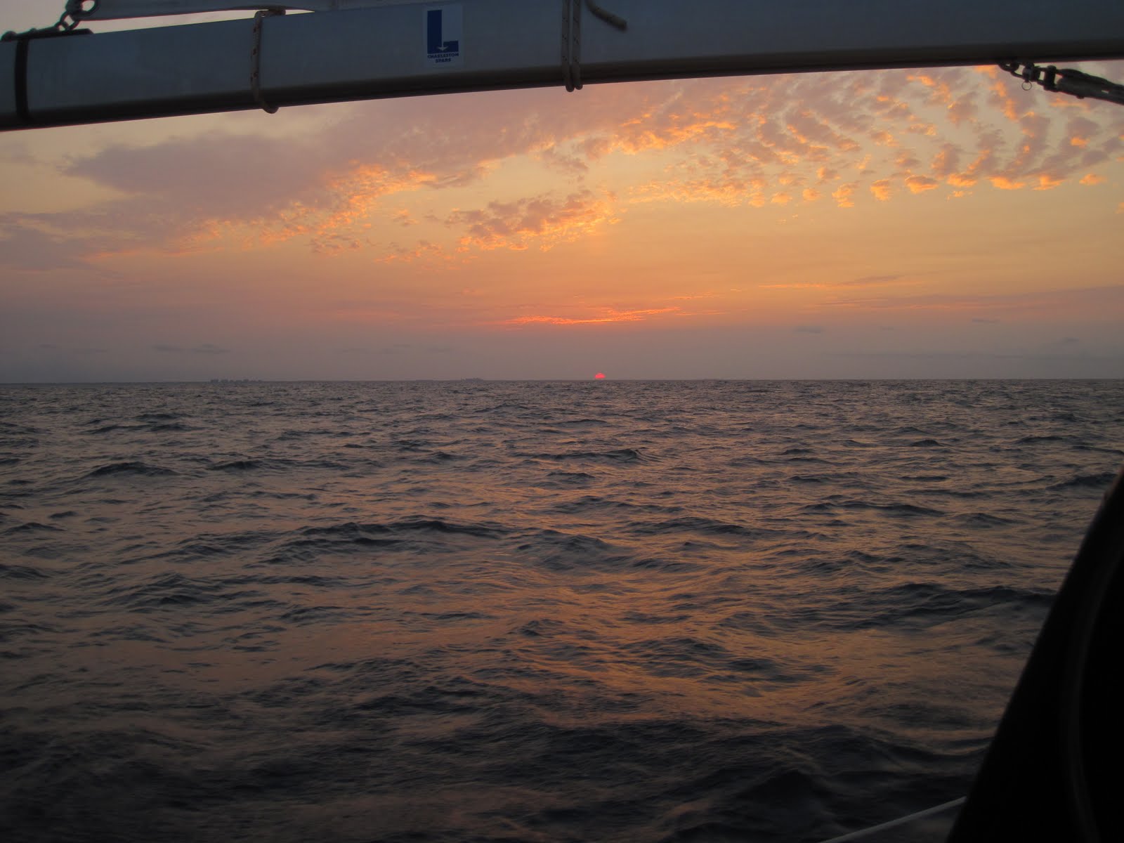
Showing posts with label Cumberland Island GA. Show all posts

Thursday, May 30, 2013

A CURIOUS PASSAGE

Charleston, SC
Our Norwegian friends conducting home school on Cumberland Island.

We've gone state-hopping. After two nights at one of our favorite stops, Cumberland Island, Georgia, we set off from the St. Mary's Inlet for an overnight passage to yet another favorite: Charleston.

The weather was finally, finally turning in our favor. The squalls skittered away and our northeast route would be blessed with 10-15 knots of east wind slowly clocking to southeast and easing at the end of the day. Then, the diurnals would kick in giving us some good wind for the night.

Well, none of that happened, but it was a beautiful trip anyway! For once, the unpredicted weather was in the other direction, lighter.

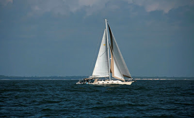
We headed into the deep at 6:30 and into pretty big swell on our beam. Under full sail, we were able to ride over it nicely.

Down:

And back up again:
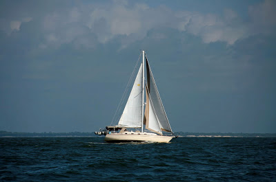

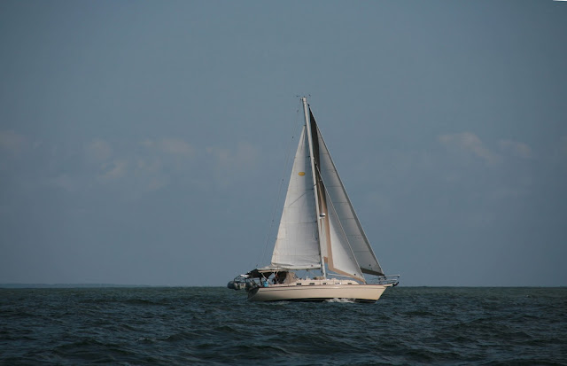
The wind didn't ease much, and it never clocked south, so we rode on the closest point of sail we could manage, which put us exactly on course to Charleston. For the first time ever, we raised the sails and never changed the set for 30 hours.

The swell laid down in the late evening for a gorgeous night of stars punctuated at midnight with a half moon.

Sometimes dolphins joined us.

Photo by Chip
We rode in on a rising tide and reached Charleston Maritime Center at exactly slack water.

A perfect passage? Almost. For the first time in three years, I got seasick. :-\ Perhaps it was the particular motion of the swell, which wasn't anywhere near as bad as the Gulf Stream crossing. Curious. I was at the helm the first three hours, and then got sick. It never left me.

Chip was a superhero, helming about 2/3 of the trip.

Another cruiser posted this excellent article about combatting and treating seasickness. I know there were several factors that made me susceptible:
  1. I didn't sleep well the night before. 
  2. We had been inshore for a week or so, on smooth waters.
  3. I started on an empty stomach.
All bad. Usually if I take a slug of Pepto before leaving, I don't have much trouble. This time I was not so lucky! I slept at least 12 hours of the passage.

Once we arrived in Charleston, the queasiness disappeared -- and Charleston awaits. Now that's perfect.


Thanks to Stian on To Be for the photos.

Thursday, June 7, 2012

CONTINUING SAGA

Shellbine Creek, GA 30º54.770N | 81º29.663W


This morning dawned overcast and spitting rain, but we have a bead on Brunswick, only 30 miles north, our final stop for the next few months as we hunker down the boat for hurricane season and prepare for our month in Paris. Let's just say, with all the weather challenges of the last few days, tucking into a quiet, safe marina sounded like paradise.

We lifted the anchor and pulled across the channel for a fuel-up when they opened at 7 a.m. Are manatees good luck? Not sure, but it was thrilling to watch this gentle, whale-like manatee having a little spa moment in the warm runoff from our exhaust.


Ah, warm water.
Off we went, optimistic and fixated on free laundry and hot showers. Rounding the northern end of Amelia Island, at the St. Mary's inlet, the clouds were making a beautiful display beyond the fort.


But the reason they were so dramatic is that a stationary front has been sticking like velcro across the Georgia-Florida border, causing wind, rain, squalls and a puzzle for the weather predictors, who keep getting it wrong, wrong, wrong. We desperately wanted to get north of the ridge, and we weren't the only ones. We spoke to several other boats along the way who were on the same mission.

It was with a certain sense of foreboding that I looked north at the dark clouds, a backdrop for an equally foreboding nuclear power plant. Soon it was raining. Then it was pouring. We kept plodding. At least it wasn't blowing. Yet.

Today's hurdle, and the last real obstacle between us and Brunswick: St. Andrew's Sound, at the northern tip of Cumberland Island (the lower right tip on that chart) and Jekyll Island just to the north. The first time we traversed St. Andrew's, I was shocked that the "intracoastal waterway" took us basically out into the ocean, through shallow water between two shoals. We have passed that way twice, both times it was like gliding on glass.

As we inched our way north, it was apparent that the Sound would not be glassy. The wind started picking up from the northeast, which would leave that Sound terribly exposed. (Outer Bankers: Imagine the Albemarle Sound open to the ocean with a stiff northeast wind.) The wind had just clocked around from the west, so perhaps, just perhaps, the swell hadn't had time to build up.

My shift came up as we were approaching the Sound (of course, sigh), just as the Cumberland River was widening.

We were almost to A1 on that map, which is an anchorage inside Cumberland Island.

Dark clouds ahead.
Let's review: We are approaching an exposed sound. The wind is now a steady 25, gusting higher. It's pouring rain. Visibility is bad. The heavy swell is already starting.

Here's the soundtrack going through my head:
--I used up a good amount of boat karma getting through the St. John's River yesterday.
--We just fueled up, and if, on the off-chance, we got bad fuel, getting tossed around in the sound would mean dead engine.
--Brunswick and safe harbor is only 20 miles away! Can you just please, please let us through?
--Anchorages available are okay, but squalls are predicted overnight.
--Will tomorrow -- or the day after -- be any better?
--The Cumberland anchorage on the southern tip of the island is well protected but at least two hours behind us.
--AAAAARRGGHHHHHH!

To add further to the frustration, the weather prediction had been for 10-15 knot wind and light chop, so it's not like we chose this.

I was at the helm, and on our boat, whoever is helming is captain. After rolling all the options around in my head for awhile, I chose the toughest option of all: I turned the boat around. It's defeating. You know you're backtracking, and to add further to the defeat and second-guessing, other boats were going on ahead. (That used to bother me a lot more than it does now. Let them have the crappy conditions.) The bottom line: we're supposed to be having fun. Unfortunately, 'fun' wasn't available in any of our bad options at that point.

We had an extended discussion about the anchorage marked A1. Coincidentally, we had tried to anchor there two years ago and didn't like it, even in fair weather. Instead we went back a tedious two miles, 45 minutes, to Shellbine Creek, on the lower left of the chart above and here's a closeup.

We anchored above the green one, about where the 9 is.
Looking at the chart, you think, oh, that will be so protected, but that's the first lesson we learned about Georgia anchorages two years ago: they are in marshland. Shellbine is a little creek running through marsh grass. No trees, hills, nothing. So, no wind block and very narrow, but good old Georgia mud that swallows the anchor like quicksand.

We found a spot in the creek that was only six feet deep at low tide, which helped our anchor chain ratio (supposed to be up to 10 times the depth, especially in heavy weather). With the creek being so narrow, we could only put out about 70 feet of chain, and, get this: six feet of tide, which would put us in 12 feet of water with only 70 feet of chain with wind in the mid 20s and squalls predicted overnight. The best I could do was put out extra snubber line (a rope hooked to the anchor chain that drops the pressure point well below the waterline, which helps the anchor to stay dug in).

The cushy night at a marina? Not tonight. Not for us. Could be a long one.

Sunday, November 13, 2011

LOVELY BACKTRACKING

Cumberland Island, GA 30º45.940N | 81º26.087W

The immaculate beach on Cumberland Island.
We've once again come to visit Cumberland Island, one of our favorite spots, with its otherworldly forests, unsullied beaches and a few wild horses to complete the scene.

This time we went farther afield with the help of our bikes, although I've come to appreciate the value of fat tires. It's quite a workout to pedal skinny tires on sandy roads.

The scenery here remains unchanged and still defies my ability to describe it. We lolled in it all day, and I offer only eye candy:


Cara Mia anchored off Cumberland Island.

Monday, June 13, 2011

EARNING OUR WAY TO CHARLESTON

Charleston, SC 32º46.832N | 79º57.599W

Attentive readers might remember how we fell in love with Charleston last December as we passed through, bookmarking it for a visit on our return swing north.

Yesterday we set off from Cumberland Island for yet another 24-hour passage, entirely skipping Georgia and its 9-foot tides.

In a frustrating continuation of our ships-passing-in-the-night phase, as we were leaving, our friends Christie and Matt on Kaleo were anchoring across the way in Fernandina, but we were glad to hear they are Charleston-bound as well.

The generous inlet of the St. Mary's River was shrouded in dense smoke as we sailed out mid-morning. Apparently large chunks of the southeast are on fire. We leave you folks in charge of the country for a few months, and you set the whole place on fire!

The wind was brisk and lovely, from the east as we set our course northeast toward Charleston. The forecast was dreamy: 0-1 meter of swell, wind in the 10-15 knot range, perhaps dropping during the night.

We passed an enjoyable day of near-perfect sailing accompanied by a strong sense of foreboding, remembering that damnable pattern of the last two passages: perfect by day; hell by night.

And you know what? We were right -- except for one thing: it was far, far worse.

After sunset, the sea state got increasingly agitated. By midnight it was tossing us about in 8-10 foot swell with a random 12-footer thrown in. What direction? On our beam, of course.

The wind apparently did not read the forecasts, because by midnight it was howling a steady 25 knots, gusting even higher. From where? You should know the answer by now: on our stern quarter, clocking slowly behind us.

Same routine as the last two overnighters with the volume on 10. Sigh.

It's a funny thing about sailing. On a tack off the wind, you loll along surfing the waves, thinking this wind isn't so bad, but then you turn on the opposite tack, and it's as if somebody switched the weather channel. The bow pounds through the waves, the screeching wind blasts against the sails (and your face) and you feel like you're rocketing out of the atmosphere -- even though, according to the knot meter, you're actually going slower.

On our two previous passages with similar but lighter conditions, we were able to hold our course reasonably well, but this time, if we kept our course, the rocking and rolling was truly unbearable. We had to zigzag west toward shore, running downwind, then east, out to sea, hopefully on average, keeping our course to Charleston.

During his 3 to 6 a.m. watch, Chip altered our course, finding a better route that was a wee bit more tolerable. On my 3-6 shift, the swell slowly, inch-by-inch started to ease and by the time I came back on watch, the sea state had calmed, and the sun was just beginning to lighten the sky.


The sun must have had a rough night too, because all morning it threatened to just go on back down.

Since when does the sun set in the east?
We passed the morning peacefully, snatching little catnaps in the cockpit thanks to calmer seas.

Well-earned rest after a fitful night.
By noon we turned into the long channel leading into our dear Charleston, dropping anchor in the Ashley River for a good long sleep, resting up for our weeklong date with this fine southern city.

Sunday, June 12, 2011

THAT TEMPERAMENTAL OCEAN

Cumberland Island, Georgia 30º46.403N | 81º28.602W
The sun setting over the calm yet capricious ocean.
How different I feel as we retrace our path north. Seven months ago, as newly minted cruisers passing through this same stretch of Florida, we had yet to sail in the ocean, still using our time toiling south for outfitting and rigging, preparing the boat and our nerves for the rigors of offshore sailing. Seven months ago, we threaded tiny stitches down the ICW, taking two weeks to cover the same distance we traversed offshore last night in only 24 hours.

Such a short few months later, we don't hesitate to abandon the grumpy bridge tenders and wake-making power boats for the mysteries of the deep.

And truly, you gotta wonder what mysteries await when you step into Neptune's territory.

With our GPS routed to our much-loved Cumberland Island on the Florida/Georgia state line, we threaded the slim Ponce Inlet mid-morning in unsettled waters, turning north in a brisk breeze from the east. We briefly considered reefing the main (pulling in some sail) but waited a bit to see how reliable that breeze would be.

The forecast was sketchy, calling for the wind to get light and clock, perhaps all 360˚ overnight with little or no swell.

They were half-right.

We had a beautiful day of sailing on smooth water with a good wind that settled right down, no reefing required.

This sure beats two weeks on the ICW!
Then the sun set and all hell broke loose. Does this remind anyone else of our Gulf Stream crossing?

The swell gradually increased after sunset, rising to 6-8 foot swells by midnight, right on our beam if we kept our course. The wind dropped and started clocking around behind us, practically useless.

These conditions always make me wonder, as I'm sure I've said here before, how loud music purloined the term Rock 'n' Roll, a name much more suited to our rock, rock, rock, ROLL. And why is it invariably in the dead of night?

On my 9-midnight watch, I struggled to get any power I could manage out of the light wind, anything to stabilize us in the broiling swell, I discovered that, oddly, the jib does better running on light wind if it's reefed. Who knew. I was able to keep it full much better by reefing it down to a smaller slice of canvas. I tried to snake as close to our course as possible without pitching us all in the drink from the rocking.

But, as predicted, the wind kept clocking, making a full circle by the time we were done.

We enjoyed the day and alternately endured the night, delighted to see the sun finally rise and the damned swell begin to unfurl.

I think I've got the ocean figured out. She's a primadonna, docile and perfectly lovely in the spotlight of day, a total freakin' bitch by night.

We set our anchor just off Cumberland after 24 hours of sad near misses. Leaving Ponce Inlet, we learned we had anchored less than two miles from our friends Eric and Annie on WeBeSailing, whom we haven't seen since we left them in Rose Island in February. Making our way into the St. Mary's inlet, Karen and Dale on Jessie Marie radioed us on our their way out, forging the path we will take tomorrow: a 24-hour passage to Charleston.

Fort Clinch on the southern shore of St. Mary's River.

Friday, November 26, 2010

INTO THE MASTS

Cumberland Island, GA 30º45.924N | 81º28.364W


Anchorage at the south end of Cumberland Island.
After three nights alone on the water, we decided to mix it up on land with lots of people. Destination: St. Mary's, Georgia. Tuesday morning we sailed into the masts.

St. Mary's anchorage in the distance.
People who travel on boats have many things in common, but on holidays, the most important is that we've all left home, family and friends behind. The kind and generous folks of St. Mary's took us all under their turkey wing, more than 100 boats, and fed us, drove us to the supermarket, the laundromat, the liquor store and the library.

For Cruisers Thanksgiving dinner, they provided turkey and ham; the cruisers brought the rest.

We found some other kids on the circuit. "Kids" now means younger than 60. You've gotta love that.

Diane & Barney from England aboard Sea Gal,
Karen & Dale from Nova Scotia aboard Jessie Marie.
Anna & Hakan from Sweden aboard Unicorn.
In my long and fortunate 50 years, I have never found it hard to find things to be thankful for, but this year the list runs over. The much more difficult task will be my Christmas list, because I can't think of anything more that I need.

Thanksgiving's foggy start.

St. Mary's, GA 30º43.097N | 81º33.101W


The dinghy pile-up in St. Mary's.
Hungry cruisers wait in line.
Sun sets on St. Mary's.
Cara Mia, happy among friends.        ©2010 Tammy Kennon

Tuesday, November 23, 2010

BEAUTY WITHOUT WORDS

Brickhill River, GA 30º51.832N | 81º28.368W


Brickhill River, Cumberland Island, GA.
Cumberland Island, Georgia, is the largest of the Sea Islands, the barrier islands along the Atlantic Coast from South Carolina to Florida. It is 17.5 miles long, 36,415 acres of marsh, mudflats and tidal creeks. The island is covered by a dense forest of live oaks hung with Spanish moss and populated by wild horses, armadillos, turkeys and white-tailed deer.

Over the centuries Cumberland Island has been inhabited by the Timucua, the Spanish, the English, the Greene family and the Carnegies. It has been raided by pirates and occupied by British troops, its trees harvested to build ships, its land tilled to grow cotton and its beauty used to entertain the powerful and the wealthy.

In 1969 the island was designated a National Seashore and today is mostly unpopulated.

These cold facts of history tell you nothing about the experience of Cumberland Island. I'm not sure prose or poetry can either. The natural beauty of this island borders on the surreal. These photos are my best offering.

Live oak canopy hung with Spanish moss.    ©Tammy Kennon
Palmettos fanning underneath the live oaks.  ©Tammy Kennon
Wild poser.     ©Tammy Kennon
Much of the island is covered by a live oak ceiling.   ©Tammy Kennon
Seemingly endless beach with white powdery sand.
©Tammy Kennon
Dungeness mansion, built in 1803 by Catherine Greene, burned to the ground in the mid-1800s.
Rebuilt by Thomas Carnegie in 1881, it burned again in 1945.

©Tammy Kennon
©Tammy Kennon
Cumberland Island, GA 30º45.924N | 81º28.364W

©Tammy Kennon
©Tammy Kennon