

Shellbine Creek, GA 30º54.770N | 81º29.663W

This morning dawned overcast and spitting rain, but we have a bead on Brunswick, only 30 miles north, our final stop for the next few months as we hunker down the boat for hurricane season and prepare for our month in Paris. Let's just say, with all the weather challenges of the last few days, tucking into a quiet, safe marina sounded like paradise.
We lifted the anchor and pulled across the channel for a fuel-up when they opened at 7 a.m. Are manatees good luck? Not sure, but it was thrilling to watch this gentle, whale-like manatee having a little spa moment in the warm runoff from our exhaust.

Off we went, optimistic and fixated on free laundry and hot showers. Rounding the northern end of Amelia Island, at the St. Mary's inlet, the clouds were making a beautiful display beyond the fort.
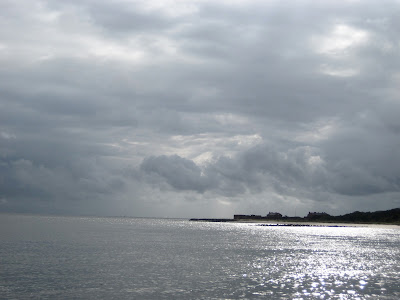
But the reason they were so dramatic is that a stationary front has been sticking like velcro across the Georgia-Florida border, causing wind, rain, squalls and a puzzle for the weather predictors, who keep getting it wrong, wrong, wrong. We desperately wanted to get north of the ridge, and we weren't the only ones. We spoke to several other boats along the way who were on the same mission.
It was with a certain sense of foreboding that I looked north at the dark clouds, a backdrop for an equally foreboding nuclear power plant. Soon it was raining. Then it was pouring. We kept plodding. At least it wasn't blowing. Yet.
 Today's hurdle, and the last real obstacle between us and Brunswick: St. Andrew's Sound, at the northern tip of Cumberland Island (the lower right tip on that chart) and Jekyll Island just to the north. The first time we traversed St. Andrew's, I was shocked that the "intracoastal waterway" took us basically out into the ocean, through shallow water between two shoals. We have passed that way twice, both times it was like gliding on glass.
As we inched our way north, it was apparent that the Sound would not be glassy. The wind started picking up from the northeast, which would leave that Sound terribly exposed. (Outer Bankers: Imagine the Albemarle Sound open to the ocean with a stiff northeast wind.) The wind had just clocked around from the west, so perhaps, just perhaps, the swell hadn't had time to build up.
My shift came up as we were approaching the Sound (of course, sigh), just as the Cumberland River was widening.
We were almost to A1 on that map, which is an anchorage inside Cumberland Island.
Let's review: We are approaching an exposed sound. The wind is now a steady 25, gusting higher. It's pouring rain. Visibility is bad. The heavy swell is already starting.
Here's the soundtrack going through my head:
--I used up a good amount of boat karma getting through the St. John's River yesterday.
--We just fueled up, and if, on the off-chance, we got bad fuel, getting tossed around in the sound would mean dead engine.
--Brunswick and safe harbor is only 20 miles away! Can you just please, please let us through?
--Anchorages available are okay, but squalls are predicted overnight.
--Will tomorrow -- or the day after -- be any better?
--The Cumberland anchorage on the southern tip of the island is well protected but at least two hours behind us.
--AAAAARRGGHHHHHH!
To add further to the frustration, the weather prediction had been for 10-15 knot wind and light chop, so it's not like we chose this.
I was at the helm, and on our boat, whoever is helming is captain. After rolling all the options around in my head for awhile, I chose the toughest option of all: I turned the boat around. It's defeating. You know you're backtracking, and to add further to the defeat and second-guessing, other boats were going on ahead. (That used to bother me a lot more than it does now. Let them have the crappy conditions.) The bottom line: we're supposed to be having fun. Unfortunately, 'fun' wasn't available in any of our bad options at that point.
We had an extended discussion about the anchorage marked A1. Coincidentally, we had tried to anchor there two years ago and didn't like it, even in fair weather. Instead we went back a tedious two miles, 45 minutes, to Shellbine Creek, on the lower left of the chart above and here's a closeup.
Looking at the chart, you think, oh, that will be so protected, but that's the first lesson we learned about Georgia anchorages two years ago: they are in marshland. Shellbine is a little creek running through marsh grass. No trees, hills, nothing. So, no wind block and very narrow, but good old Georgia mud that swallows the anchor like quicksand.
We found a spot in the creek that was only six feet deep at low tide, which helped our anchor chain ratio (supposed to be up to 10 times the depth, especially in heavy weather). With the creek being so narrow, we could only put out about 70 feet of chain, and, get this: six feet of tide, which would put us in 12 feet of water with only 70 feet of chain with wind in the mid 20s and squalls predicted overnight. The best I could do was put out extra snubber line (a rope hooked to the anchor chain that drops the pressure point well below the waterline, which helps the anchor to stay dug in).
The cushy night at a marina? Not tonight. Not for us. Could be a long one.


This morning dawned overcast and spitting rain, but we have a bead on Brunswick, only 30 miles north, our final stop for the next few months as we hunker down the boat for hurricane season and prepare for our month in Paris. Let's just say, with all the weather challenges of the last few days, tucking into a quiet, safe marina sounded like paradise.
We lifted the anchor and pulled across the channel for a fuel-up when they opened at 7 a.m. Are manatees good luck? Not sure, but it was thrilling to watch this gentle, whale-like manatee having a little spa moment in the warm runoff from our exhaust.

 |
| Ah, warm water. |

But the reason they were so dramatic is that a stationary front has been sticking like velcro across the Georgia-Florida border, causing wind, rain, squalls and a puzzle for the weather predictors, who keep getting it wrong, wrong, wrong. We desperately wanted to get north of the ridge, and we weren't the only ones. We spoke to several other boats along the way who were on the same mission.
It was with a certain sense of foreboding that I looked north at the dark clouds, a backdrop for an equally foreboding nuclear power plant. Soon it was raining. Then it was pouring. We kept plodding. At least it wasn't blowing. Yet.

As we inched our way north, it was apparent that the Sound would not be glassy. The wind started picking up from the northeast, which would leave that Sound terribly exposed. (Outer Bankers: Imagine the Albemarle Sound open to the ocean with a stiff northeast wind.) The wind had just clocked around from the west, so perhaps, just perhaps, the swell hadn't had time to build up.
My shift came up as we were approaching the Sound (of course, sigh), just as the Cumberland River was widening.
We were almost to A1 on that map, which is an anchorage inside Cumberland Island.
 |
| Dark clouds ahead. |
Here's the soundtrack going through my head:
--I used up a good amount of boat karma getting through the St. John's River yesterday.
--We just fueled up, and if, on the off-chance, we got bad fuel, getting tossed around in the sound would mean dead engine.
--Brunswick and safe harbor is only 20 miles away! Can you just please, please let us through?
--Anchorages available are okay, but squalls are predicted overnight.
--Will tomorrow -- or the day after -- be any better?
--The Cumberland anchorage on the southern tip of the island is well protected but at least two hours behind us.
--AAAAARRGGHHHHHH!
To add further to the frustration, the weather prediction had been for 10-15 knot wind and light chop, so it's not like we chose this.
I was at the helm, and on our boat, whoever is helming is captain. After rolling all the options around in my head for awhile, I chose the toughest option of all: I turned the boat around. It's defeating. You know you're backtracking, and to add further to the defeat and second-guessing, other boats were going on ahead. (That used to bother me a lot more than it does now. Let them have the crappy conditions.) The bottom line: we're supposed to be having fun. Unfortunately, 'fun' wasn't available in any of our bad options at that point.
We had an extended discussion about the anchorage marked A1. Coincidentally, we had tried to anchor there two years ago and didn't like it, even in fair weather. Instead we went back a tedious two miles, 45 minutes, to Shellbine Creek, on the lower left of the chart above and here's a closeup.
 |
| We anchored above the green one, about where the 9 is. |
We found a spot in the creek that was only six feet deep at low tide, which helped our anchor chain ratio (supposed to be up to 10 times the depth, especially in heavy weather). With the creek being so narrow, we could only put out about 70 feet of chain, and, get this: six feet of tide, which would put us in 12 feet of water with only 70 feet of chain with wind in the mid 20s and squalls predicted overnight. The best I could do was put out extra snubber line (a rope hooked to the anchor chain that drops the pressure point well below the waterline, which helps the anchor to stay dug in).
The cushy night at a marina? Not tonight. Not for us. Could be a long one.


No comments:
Post a Comment