Saturday, November 20, 2010

THE SCIENCE OF PINK

Wahoo River, GA 31º36.092N | 81º013.008W


The grandeur of nature rattles my senses. 
A pale yellow sun timidly struggles through clouds 
and reflects on steely gray waters. 

Surreal, endless water, 
glistening, marsh grass gold, 
explosive against the sheer artistry 
of gray on gray on gray on blue.


The sweeping and overwhelming subtlety 
makes me feel inadequate to appreciate 
what's been spread before me. 
And yet, I partake. 
I attempt to capture. 
I hack at description. 

I fail.

Nature's splendor is larger than words, 
larger than lenses 
and my tiny human effort to capture it.

I am reduced to the single moment. 
The utter silence of gray. 
The screech of gold. 
The sweet and gut-wrenching science of pink 
wrought by sun and bits of atmosphere.


Which cloud cares if I have traveled three miles 

or fifty 

or five thousand 

or none at all?

Darien River, GA 31º23.046N | 81º20.043W


THROUGH THE GATE OF HELL

Isle of Hope, GA 31º58.756N | 81º03.345W
Boats anchored at sunrise in Isle of Hope, GA.
Any day that begins with leaving Isle of Hope and heading for Hell Gate seems inauspicious, to say the least. And then we passed this:


Well, dang. Then I look at the GPS and even it is telling me TURN BACK!

Note the yellow arrow, which usually points the direction we should be heading,
in this case telling us to GO BACK, GO BACK!!!
Hell Gate is known for shoaling and shallow waters, so we left early to pass through at favorable tide having finally learned to use the tides to our advantage.


Also having learned some tricks to narrow, shallow passages, we made it through Hell Gate slowly grounding-free. Onward through placid marshlands with time for reflection -- and blogging.


We dropped anchor before low tide in the early afternoon, in the Wahoo River, alone but for hundreds of waterbirds calling around us. A day that started with eery omens passed ever so gently as years of tension dripped out the ends of our fingers and washed away in a quiet current.


The sun set on the marshy scene and the moon rose over our private spot, the lone evening guests of the fish and fowl.

Wahoo River, GA 31º36.092N | 81º013.008W

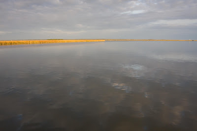
Reflective waters along Georgia's marshlands.
Skidaway Bridge near Isle of Hope.


ALL-new, 3D Animation
ultra-real-life online game!!!!!!!!!!!!!! 

Take the ultimate mariner's challenge through shallow, murky waters, swiftly running currents and heavy traffic as you make your way past unexpected hazards at every turn! Shoals, sunken vessels, rocks and other underwater perils await the intrepid traveler!

Test and hone your skill as you navigate the infamous Rock Pile, Hell Gate, Little Mud River and the dreaded Shallows of McClellanville through capricious weather pounding you with high wind, freezing cold, dense fog and pouring rain.

Employ complicated formulas to complete passages in daylight, figuring the speed of your vessel changing with and against roaring tides and shifting currents, narrow passages and heavy traffic that slow you down, all threatening to make you fall short of safe harbor before dark of night, which steals in a little earlier at each level. At Level 5, if you are skilled enough to make it that far, Daylight Savings Time will take away yet another hour of sunlight, shortening your opportunity to tie up before the chill of darkness descends.

Travel through spectacular 3D coastal scenes featuring full-color sunrises and sunsets, lifelike dolphins, cormorants and alligators. Navigate marks that may or may not have changed equipped with conflicting depth meters, fickle instruments that sometimes show you passing over land and charts that challenge your spatial relations by appearing in exact reverse of what you see on your screen.


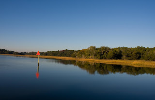
Use your puzzle-solving skills to search out and read directional marks just out of site distance, low on the water. As an extra challenge, the red marks have red numbers, and green marks with green numbers are placed just above the waterline, frequently against green trees and low green shrubbery onshore.

Earn points along the way to be used for free rescue by SEA TOW or be left aground waiting for the next tide swing as other players get the advantage.

Gain lives by chatting with other players on the VHF and at anchorages and get tips on what perils lay ahead by cashing in cheese and crackers points earned at provisioning outposts. Further local knowledge can be gained at small, sketchy bars, but caution prevails in choosing your sources and wielding the information gained wisely lest you be sent on the wrong path.

Be wary of point loss by crashing into other players with your vessel, passing without hailing on the radio, anchoring too close to other vessels, cursing on the VHF, dumping waste overboard or arriving at marinas after dark. 

New features in the latest version include bonus points for being mentioned in another player's blog and environmental point loss for colliding with sea life or spilling diesel fuel in the water. 

Challenge your skills by adding the bridge feature where low obstacles are placed in your path, some opening on the hour, some on the half hour, some by request, some based on complicated and highly secret algorithms and some at the gamemaker's whim. Others remain closed during certain tide changes, and some open only partially, the ultimate test of your piloting skills. Bonus points awarded for passing through these overhead obstacles in swift current and heavy traffic.

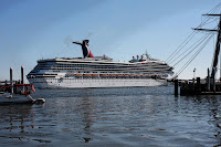
Traverse the levels traveling with and against mammoth barges, towering fishing boats, some with nets spread in the channel, dozens of buzzing recreational craft who mark you as a target and high-powered motor vessels creating massive wakes that rattle your vessel and knock you off your path. Pass through major inlets and harbors dodging gargantuan cruise ships, large passenger ferries and cargo ships that loom up on your screen as waterborne buildings.

The true survivors who reach Level 10, will be confronted not only with the challenges of the lower levels but will be faced with the addition of increasing tides that swing by a frightful 9 to 10 feet, currents that change direction every two to three miles, side currents in shallow, poorly marked cuts and as daylight hours grow shorter, safe anchorages become fewer and farther between.

The lucky will take refuge in idyllic spots like Isle of Hope, Moon River and Beaufort, and the highly skilled will be rewarded at the end with warm turquoise waters and tropical islands. Are you one of the lucky ones?


Find out now. 
Play ICW: SURVIVAL! today.

Boat sold separately.


Friday, November 19, 2010

NEW STATE OF MIND

Beaufort, SC 32º25.837N | 80º40.583W
The entrance to Field's Cut on the ICW in Georgia.
I left Beaufort feeling sad and mopey (is that one of the dwarves?), but the second we pulled out onto the ICW, my spirits lifted. Note to self: Feeling blue? Get moving!

We slipped quietly out of South Carolina, across the Georgia state line.

By the time my shift at the helm came, I was feeling all new and happy, even the GPS was smiling at me.


I would soon learn it was not smiling. It was laughing at me.

I might have had a new state of mind, but the pattern is an old one. My shift started as we entered Field's Cut where "reported water at mean low tide was three to four feet."

When were we entering? Mean low tide. I mean. I might also add, it seemed much more "Field" than "Cut."

Ah well, forge ahead at mean low speed. I navigated it without anything worse than clenched teeth.

As we approached the town called Thunderbolt, this time with Chip at the helm, I radioed Causton Bluff Bridge to request an opening.

"Be advised, only half of the bridge will be opening."

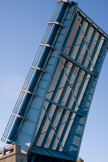
Causton Bluff Bridge near Thunderbolt where half the near bridge section didn't open.
Bad photo, good illustration of a claustrophobic opening.
All day on the VHF, I had been taunted by the oft-repeated, "Isle of Hope, Isle of Hope." We could have made it farther, but how can you pass Isle of Hope, especially when it's billed as one of the prettiest spots on the ICW? It is.

We were walking the 1 1/2 miles to the local pub/restaurant when one of the marina dockhands stopped to give us a ride.

I opened the back door of his truck, and out tumbled three large, matching books about the size of the Reader's Digest Condensed Version -- right onto the road.

"Wow, what are these," I asked as I read the spine, "Millennial Harbinger."

"I'm a seminary student. I'm writing a paper on the Church of Christ and their stance on slavery."

Okay, I was not expecting that.

Isle of Hope, GA 31º58.756N | 81º03.345W
Now THAT'S a shoal.
Moon over beautiful Isle of Hope.